A Connected Network of Protected Lands
Click image for larger view.
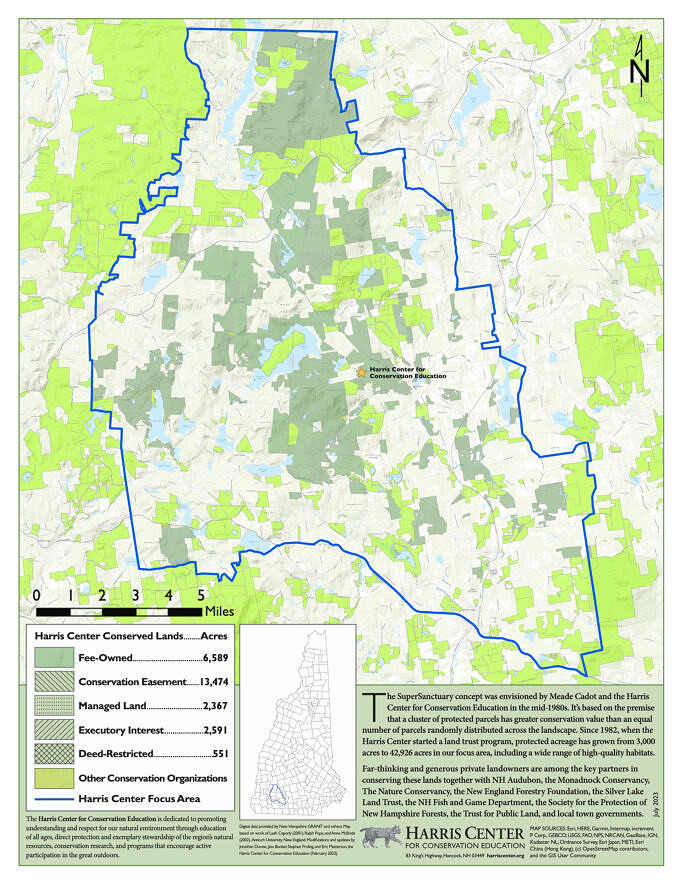
The SuperSanctuary is comprised of nearly 44,000 acres of connected, protected land in the Monadnock Region of southwest New Hampshire, including portions of the towns of Antrim, Dublin, Greenfield, Hancock, Harrisville, Nelson, Peterborough, and Stoddard.
The SuperSanctuary features:
- 23 peaks over 1,500 feet in elevation
- shorefront surrounding or abutting 18 lakes and ponds
- 95 miles along rivers and streams
- 21 miles of hiking trails
- several scenic roads
- more than 1,600 acres of diverse wetlands
Contact Us
For more information on the Harris Center’s land protection program, please contact Eric Masterson at (603) 525-3394 or by email.


